Exploring the wonders of geology in response to young-Earth claims...

Never been here? Please read my guidelines and background posts before proceeding!

Friday, November 19, 2010

Methods to Dr. John K. Reed's Madness: Deconstruction and the Geologic Timescale, Part 1

While many researchers in geology are committed to describing the fundamental processes of our dynamic Earth, others attempt to elucidate the details of Earth history by investigating the rock record. For example, a volcanologist might study gases and lava emitted from a modern volcano to assess the volcano’s effect on the atmosphere (how much carbon, sulfur, etc. it emits) or whether it poses danger to the surrounding life. To accomplish this goal, the volcanologist might analyze the chemistry of the rocks to answer questions like: How deep/hot is the magma chamber? How explosive (viscous) is the lava? How often has the volcano erupted in the past? Are there any tectonic forces promoting volcanism? A thorough scientific investigation thus requires the volcanologist not only to consider the physics behind volcanic eruptions, but to examine the rock record for clues about the region’s volcanic history.

Yet geologists commonly take for granted the philosophical distinction between experimental and historical approaches in their research, and consequently receive criticism from a range of skeptical observers. “Nobody was there to observe it. You are simply making assumptions about the past and extrapolating the data over long time periods. This is not science because it is not falsifiable!” If you are a geologist (or a historian, for that matter), you are probably familiar with such claims, but I am willing to speculate that few of you have found necessary occasion to defend against them. So what do you do when a majority of the public discredits historical science, even mocking it as an oxymoron? Your best bet may be to continue in your research, realizing that when applied properly (confined by a common scientific method) a combination of historical and experimental approaches is capable of producing accurate and, most importantly, falsifiable results. But in the hope that I have spiked your interest, I want to consider a recent criticism of dating methods commonly used in geology.

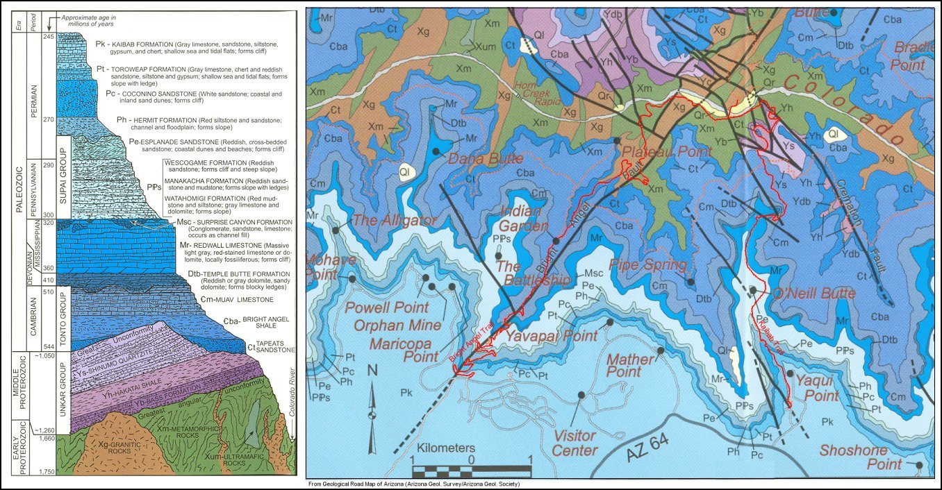
And if you are not a geologist, then I hope you are still curious as to how the geologic timescale is constructed, and how we know whether those methods are reliable. So click here to download a PDF of the timescale, and let’s get into it!

The challenge


In a 2008 Creation Research Science Quarterly article, Dr. John K. Reed examined what he termed “the starting rotation” of dating methods – that is, four geological methods used to assign ages to rocks. The rotation includes radiometric dating, biostratigraphy, astronomical tuning, and isotope chronostratigraphy (or chemostratigraphy). [If you have no idea what any of these words mean, then you are in for a treat, because all of them are fascinating and I’m here to explain!] After a brief discussion of each method, Dr. Reed concluded:

‘The current stable of “scientific” methods is riddled by uncertainty, and a very large
element of faith is needed to believe that they constitute a valid and verifiable chronometer of Earth’s supposed 4.5 billion-year past. In reality, there is no “silver bullet,” no single absolute clock that has measured uniformitarian history.’

So we are left with the impression that: 1) we have yet to find an absolute time-piece of Earth history; 2) there is much reason to doubt the validity of published dates; 3) the scientific nature of each method is sufficiently questionable to earn “quotation marks”; and 4) there is such a thing as uniformitarian history.

I want to draft my consideration of Dr. Reed’s claims over two articles. Below, I will consider the scientific background of geologic dating methods. In the next article, I will look more specifically at the individual methods and Dr. Reed’s assessment thereof.

Using a multiplicity of geological dating methods is like taking pages from a diary


For this analogy, I only require that you have an imagination. Imagine, for example, that you discovered a box of personal diaries from the burnt ruins of an old, countryside village. Your hope is to piece together the historical details of that village — maybe to better understand its reaction to political turmoil in the major cities? — and the diaries are your only hope. But there is one problem. The diaries are old and worn down, which renders them all incomplete. Furthermore, exposure to fire/smoke, and perhaps some water damage has erased the entry date for a majority of the pages. Is it still possible to apply a scientific method to reconstructing the history?

Let’s take a look at a single diary. It appears that in the 200 pages of entries, the entry date is still clear for 15 of those pages. This provides an absolute chronometer, meaning that it allows us to assign a real age to when those 15 pages were recorded. As for the rest of the entries, we can apply some relative methods of dating. For example, we can calculate the average number of pages between pages of a known age to get an idea of how often the person made a diary entry. We may also want to investigate the continuity of each record. In other words, phrases like “it’s been a long time since my last journal entry” can tell us where time gaps may exist in the record. Lastly, we can look at specific events (festivals, dates of birth/death of villagers, mention of a meteor shower or forest fire, etc.), but for this we require the other journals. If one journal contains a specific date for the marriage of villagers A and B, then we can assign that same date to journal entries from other diaries that mention the same marriage.

Of course, our historical reconstruction does not come without significant assumptions. Foremost, we assume the diaries were constructed by methods observed today: a living person drafted each page by their own hand, and that entries were made on sequential pages and reflected their thoughts at the time. We are assuming that the calendar age of the journal corresponds to our own calendar age, and that the author was not mistaken when he/she recorded the date. Our relative dating methods also rely on assumptions about the consistency of journal entries. Using specific events as markers assumes that each journal is referring to the same event, and that the date of the entry in which it was mentioned corresponds to date it actually took place (maybe the person was recalling an event from the year before?). And that is where the scientific method comes into play. In our reconstruction, we must apply a specific criteria to how we obtain dates, and how to decide whether assumptions in our method were falsified. If using our initial method tells us that according to Journal A, villager C was born in 1824, but according to Journal B, the same villager was born in 1794, then we have falsified the method and need to refine it. On the other hand, if our refined methods consistently predict the correct age of journal entries for multiple journals, then we have good evidence that the model is reliable. In other words, imagine now that a new laboratory method allows you to obtain the journal entry date from damaged pages. If the laboratory results are consistent the age you predicted for the entry, then your model is predictive and has great scientific value. If the combined methods produce the same history from each journal, then your method is also internally consistent. When it comes to historical science, the goal is to construct a model that is both predictive and internally consistent.

How does this apply to geology? Early on, geologists dealt primarily with relative dating methods in constructing the geologic timescale. One such method was biostratigraphy, which correlates rocks based on the types of fossils they contain (like using people mentioned in diary entries). [On a side note, it was not until the 17th century that scientists widely accepted that fossils came from once-living organisms. Sound crazy? Put yourself in the shoes of a Medieval/Classical scholar, and try to describe a process by which living matter can be turned into stone without sounding like an alchemist!] The work of Nicolas Steno was seminal to modern paleontology and stratigraphy, as he provided good evidence for the biological origin of fossils and suggested that the relative ages of rock layers could be estimated by stratigraphic relationships — namely: 1) sedimentary rock layers are younger than the rocks below them; 2) sedimentary rock layers were originally deposited horizontally and were laterally continuous; 3) rocks that cut through another type of rock are younger than the rock through which they cut. Within 200 years, geologists applied the methods of Steno to rock layers around the world and constructed a rough geologic timescale. There was still one problem, however. Although the timescale predicted which rock layers and organisms were older or younger than others (the order of events), it could attach a real date to neither. Geologists had no way to obtain specific dates for any of the pages, and thus lacked an absolute chronometer.

Calendar under construction

Early geologists attempted to estimate the age of rocks using known rates of sedimentation and extrapolating backward, but the method was limited and made too many assumptions about the continuity of the rock record (much like assuming a constant frequency and length of journal entries). By the mid-twentieth century, however, the discovery of radioactivity and isotopes allowed scientists to formulate a method (radiometric dating) that could potentially assign the absolute ages for which they had so hoped.

And so they went to work. Thousands of radiometric dates were acquired using elements like potassium and argon, rubidium and strontium, uranium and lead, etc., for which radioactive isotopes decayed at a known rate. Intrinsic to the method were several assumptions: a constant decay rate, known initial concentrations, a closed system, etc. In other words, they created a scientific model and applied it to the modeled geologic timescale that had been constructed. But the real test was whether the combined model was both predictive and internally consistent. Thus rocks from strata identified as Cambrian should yield radiometric dates older than rocks from Devonian strata, which should yield radiometric dates older than Triassic strata, and so forth. Furthermore, historic volcanic rocks (from eruptions that occurred in human history) should give approximately no age at all.

It is perhaps of no surprise to you that results from the first decades of geochronology were very promising. In general, rocks predicted to be old yielded very old dates (e.g. Fairbairn et al., 1967; Welin et al., 1980), while rocks predicted or known to be young yielded rather young dates (e.g. Dalrymple, 1969). Furthermore, radiometric ages of meteorites clustered around 4.55 billion years (Patterson, 1956) – the age assigned to the Earth itself. By this point, a history of geologic events (such as major extinctions and appearances of certain organisms, ancient lava flows, etc.) had been constructed using relative dating methods. Thus geologists worked hard to assign accurate ages to events that could be used as time-markers in the geologic record. If, for example, scientists could measure the age of lava flows coincident with the Permo-Triassic extinction (the largest known extinction in Earth history) in one part of the world, they could assign the same age to rocks that recorded the fossil transition in other parts of the world. In the decades to follow, a bulk of radiometric dating results showed the modeled geologic timescale to be both predictive and internally consistent to a reasonable extent, but the model was by no means perfect. Some rocks yielded very different dates, depending on the method used. Others yielded dates that were obviously too old (or too young) to be accurate (e.g. Brewer, 1969; Dalrymple, 1969). Early on, Pasteels (1968) summarized radiometric dating methods in use, and concluded with a rather prophetic exhortation:

“All methodological approaches to geological problems are interconnected. Geochronology as such does not exist; the interpretation of the results must take into account field, petrographic, geochemical, and geophysical evidences...It is hoped that the progress of interpretative geochronology will not be retarded, but that a clearer picture of many points presently debated will shortly emerge. However, when all difficulties of interpretation have been resolved, many fundamental questions...will also be resolved. The progress of geochronology depends on the progress of geology in
general, but it may also contribute towards this general progress.” (emphasis added)

Making an “ASS” out of “U” and “ME”

Every scientific pursuit involves assumptions – this should come as no surprise. But the conclusions reached are only valid as long as the assumptions hold. When Lord Kelvin estimated the age of the Earth to be no more than ~24 million years, he assumed the Earth started as a sphere at a given temperature, cooling only by radiative heat loss and with no heat being added thereto. The discovery of radioactivity showed that significant heat was being added to the Earth, however, thereby invalidating his conclusion. Making assumptions in science is not a bad thing, rather it is a necessity, and assumptions must be tried and verified just as the interpretations that follow from those assumptions.

A scientific model is only valid to the extent that it corresponds to reality. Gravitational theory predicts a constant downward acceleration for all objects near the Earth’s surface (~9.81 m/s^2). But what if I tried to prove the model wrong by measuring the acceleration of a feather when I dropped it? Obviously my calculation will be much lower than gravitational theory predicts, but I have done nothing to invalidate the model (by the way, I’m referring to the model of how objects are predicted to respond to the force of gravity according to gravitational theory). The reason is that the model assumes no other force acting on the object (in this case, drag from air resistance) and therefore does not correspond to physical conditions in my experiment. When a geologist analyzes a rock to obtain a radiometric age, he/she does not consider the number to be an absolute age. Rather it is a model age for when the rock/mineral was last at a given temperature. Thus inconsistent (discordant) ages do not necessarily invalidate the model (radiometric dating), which makes assumptions about the physical history of the rock/mineral being analyzed. When a geologist obtains an age that contradicts the broader model of geologic history, he/she must also verify the assumptions intrinsic to the model. Note that by this line of reasoning, radiometric dating methods do not prove the age of rocks, or the Earth for that matter, any more than dropping rocks in a vacuum proves gravitational theory. Both attempt to construct an internally consistent model that explains the relevant data while making a set of assumptions about the universe.

Before you all run off as skeptics, I’ll let you in on a little secret: science doesn’t prove anything. The goal of scientific methods is to falsify hypotheses. Science is self-correcting in that hypotheses/models not corresponding to reality are frequently disproven, while models that explain reality very well are widely accepted. Yes, widely accepted models can be overturned and paradigm shifts commonly occur. Nonetheless, this happens through mounting scientific evidence against the prevailing model and in favor of a new one that better explains the data.

“All models are wrong, but some are useful”

By definition, scientific models are a simplified representation of reality used to understand how things work. As such, they are not meant to be infallible in their predictions. Geological dating methods are scientific models used to interpret Earth history. Radiometric dating is the only method capable of yielding an “absolute age” (i.e. our calendar date) for a vast majority of Earth history, but geologists recognize it as a model that is ever being refined. The reason I have spent so much time discussing models and falsifying hypotheses is that Dr. Reed seems to misunderstand this basic concept in his article, particularly when he claims that the assumption of deep time precludes dating methods from proving deep time (i.e. that certain rocks are many millions of years old). Furthermore, he criticizes the methods apart from their intrinsic assumptions, replacing them instead with his own assumptions about Earth history, and then pronounces the case closed. Finally, he misunderstands the use of multiple, overlapping dating methods in geology, and believes that the need for multiple methods compounds the uncertainty and unreliability of individual methods, rather than strengthening the model as a whole.

Take a step back to the ‘diary reconstruction’ analogy. Each approach to interpreting history from a single diary was riddled with uncertainty and relied on falsifiable assumptions. Yet when combined, and proven to be internally consistent and predictive, the uncertainties in our reconstructed history were reduced and we could make a solid case for its accuracy. In the next article, I want to discuss uncertainties in individual dating methods and show that in a majority of cases, individual methods are consistent and predictive of one another. Pasteels (1968) was correct in his assessment that the development of geochronology would depend on advances in geology as a whole. New technologies, which allow geologists to analyze minerals on the micron scale, have greatly improved our understanding of the physics behind radioactive decay and the retention of daughter elements, thereby explaining many of the discrepancies early researchers had suspected. Better documentation and correlation of fossil species has increased the resolution at which we can investigate periods of Earth history. Advances in magnetostratigraphy (a technique that analyzes the alignment of magnetic minerals in rocks) and continued research in the Deep Sea Drilling Project have provided an additional link between sedimentary and igneous rock records. Finally, studies in the field of chemostratigraphy (my own field) continue to provide some of the most important tests of all: 1) they verify key assumptions about the nature of the sedimentary and fossil records, by providing evidence that these layers/fossils represent isochronous intervals of Earth history; 2) they test whether other methods can accurately predict the proper age of rocks around the world; 3) they allow us to identify and interpret paleoclimatic and paleoceanographic events in Earth history, such as changes in geochemical cycles and the composition of the ocean/atmosphere. If Dr. Reed and other YECs want to dismiss these models or overturn them, it will require them to provide a new, internally consistent model that better explains the range of data.  So far, this model does not exist.

References cited:

Brewer, M.S., 1969, Excess radiogenic argon in metamorphic micas from the eastern Alps, Austria: Earth and Planetary Science Letters, v. 6, p. 321-331.

Briden, J.C., Henthorn, D.I., Rex, D.C., 1971, Paleomagnetic and radiometric evidence for the age of the Freetown Igneous Complex, Sierra Leone: Earth and Planetary Science Letters, v. 12, p. 385-391.

Dalrymple, G.B., 1969, 40Ar/36Ar analyses of historic lava flows: Earth and Planetary Science Letters, v. 6., p. 47-55.

Fairbairn, H.W., Moorbath, S., Ramo, A.O., Pinson, W.H., Hurley, P.M., 1967, Rb-Sr age of granitic rocks of southeastern Massachusetts and the age of the lower Cambrian at Hoppin Hill: Earth and Planetary Science Letters, v. 2, p. 321-328.

Pasteels, P., 1968, A comparison of methods in geochronology: Earth Science Reviews, v. 4, p. 5-38.

Patterson, C., 1956, Age of meteorites and the Earth: Geochimica et Cosmochimica Acta, v. 10, p. 230-237.

Welin, E., Lundegårdh, P.H., Kähr, A.M., 1980, The radiometric age of a Proterozoic hyperite diabase in Vrmland, western Sweden: Journal of the Geological Society of Sweden, v. 102, p. 49-52.

Monday, November 15, 2010

What produces order in the fossil record?

If you can recall anything from Earth science classes during middle school and college, then the answer to this question may seem obvious: new types of organisms appear in the fossil record based on when they evolved, thereby recording the development of life on Earth. Strange marine creatures are found at the base, reflecting a colorful assortment of life forms that inhabited the Cambrian ocean. Shortly (geologically speaking) after this, land-dwelling reptiles and plants show up in terrestrial deposits, while various fishes (including sharks) continue to develop in the oceans. Once life on Earth could breathe, walk, and climb, it was only a matter of time before it took to the skies, and so birds of all sorts are found since the early Mesozoic. Very likely, you were most fascinated with the land giants and sea monsters that culminated in the Jurassic and Cretaceous periods, only to meet their end at the great diversification of mammals in the Cenozoic. Mammals had previously been confined to small ecological niches, and were no larger than modern mice and rats, but would eventually grow into towering mammoths, equally impressive cats, horses, rhinos, wolves, bears, primates, and...well, the list goes on!

Not surprisingly, this basic idea has been challenged since its inception, and my example for this week comes from another article by Dr. Andrew Snelling of AiG, entitled Order in the Fossil Record. There, Dr. Snelling not only challenges the conventional interpretation that the order of organisms in the fossil record represents the evolutionary history of life, but presents a model employing the Flood as the mechanism for fossil sorting and preservation in the sedimentary rocks that are now a mausoleum of Earth’s past life forms. The best way to do this, he argues, “is to examine a geographic region where the rock layers and fossils are well exposed and well studied. A spectacular example is the Colorado Plateau of the southwestern USA, and more specifically, the Grand Canyon—Grand Staircase rock layers sequence.” If you’ve visited any of the national parks found in this region, then you can certainly appreciate his reasoning. Nearly 3 miles of sedimentary rock layers are found stacked upon one another, and exposed in hundreds of miles of canyons and cliffs throughout northern Arizona and southern Utah. So what do the fossils of these rocks reveal? Before answering that question, let’s consider the Flood geology model.

Flood geology and the Grand Canyon/Grand Staircase sedimentary sequences

In case you are not familiar with the basic geology of the Grand Canyon, a graphic overview of sedimentary rock layers can be found here, while Dr. Snelling provides a summary of fossils found in the whole sequence here (downloads a 1-page pdf file).

At the base of the Grand Canyon lies a world famous example of an angular unconformity (see photo here), called the Great Unconformity. This means that sedimentary rocks were deposited in the Precambrian (or before the Flood), hardened into rock, and then tilted upward by tectonic forces before erosion flattened and scoured the surface, onto which the next set of sediments could be deposited. Flood geologists generally interpret the Great Unconformity as an erosive boundary that marks the onset of the Flood (Austin, 1994). It is a regional discontinuity that is also present in southern Nevada and northern Utah, and separates Phanerozoic sedimentary rocks (Cambrian through recent) from underlying Precambrian sedimentary rocks (Unkar and Chuar groups) and crystalline basement rocks (i.e. igneous granites and metamorphic schist bodies). Although numerous fossils are present in the Precambrian Chuar group, they are typically algal in origin (e.g. stromatolites, concretions of algae called acritarchs, etc.), and are thus consistent with the presence of rather calm oceans during the pre-Flood period.

As the Flood ensued, raging waters rushed over the continent, carrying with them millions of tons of sediment (sand, silt, carbonate mud), which was deposited in the layers seen today. Not surprisingly, a vast majority of organisms living at that time were swept away by the sediment-loaded waters and entombed within the sequence. Tracks of animals desperate to escape (such as trilobites) can be found in the Tapeats Sandstone at the base of the sequence, while their bodies are abundant in the overlying layers. The order of marine fossils thus represents local environments of organisms in approximately the same order they were swept up by the flood. Presumably, rising and falling waters left alternating ‘continental’ deposits, dominated by sandstone and shale that carried land-dwelling organisms, and ‘marine’ deposits, dominated by carbonate mud and shale that carried ocean-dwelling organisms. At the same time, larger, more buoyant animals (such as elephants, horses, etc.) not only had the instincts to escape danger, but were preferentially kept from burial until the end. Thus the order of fossils seen throughout the Grand Canyon Supergroup (and overlying layers in the Grand Staircase) reflects a combination of several mechanisms: 1) ecological zonation, which is determined by the original habitat of the organism (e.g. deep marine, shallow marine, coastal, upland); 2) survivability, which was determined by the organism’s ability to escape catastrophic burial; and 3) hydrodynamic sorting, in which moving waters could sort organisms into different groups based on shape/size.

Precambrian geology of the Grand Canyon

As I began researching this article more in depth, I came to appreciate why most geological research in the Grand Canyon has focused on the Precambrian units (namely, the Unkar Group, Nankoweap Formation, Chuar Group, and Sixtymile Formation). Together, these units comprise some 3,900 meters (that’s 2 1/2 miles) of sedimentary rocks. That’s not including up to 300 meters of lava flows (with interbedded sandstone), and the fact that the rocks were faulted both during and after deposition, which was followed by broad-scale folding. A geologic history longer than the main rocks of the Grand Canyon is buried directly below it, and has conveniently been swept into the “Pre-Flood” category without much consideration. Most of the rocks are marine limestone, dolostone, and shale, indicative of calm tropical seas. Keep in mind that elsewhere, Dr. Snelling proposed that dolomite should not form in vast quantities in the ocean, hence the need for volcanic fluids associated with the Flood as a dolomitizing mechanism. Furthermore, abundant fossils can be found in the sediments of the Chuar Group, yet none of them are multicellular, let alone hard-bodied (i.e. shelled) organisms, like those found in the Cambrian strata. Bioherms, stromatolites, and other algal features are abundant, which Dr. Snelling notes is “hardly surprising” given that these sediments were not buried catastrophically. But are we to believe that not a single shell, tooth, scale, or anything else was preserved in sediments that were accumulating until the day of the Flood? If you’ve been to the beach, you’ll notice right away that shell fragments are littered throughout the coastal sands (and deeper water substrate if you care for a scuba-diving adventure). However, Dr. Snelling would have us believe that none of them were preserved in the young (<2,000 years) pre-Flood sediments, and that a majority were not even preserved in the Paleozoic sediments (Cambrian through Permian).

In conclusion, I believe that the Precambrian sedimentary rocks of the Grand Canyon (and many other parts of the world, for that matter) provide an insurmountable challenge to Flood geology. Thus I will devote a later article to this matter in particular. For now, I will continue under Dr. Snelling’s assertion that these sediments simply belonged to the pre-Flood ocean.

I say fossil, you say...fossil?

When I say the word fossil, what do you envision? Perhaps you have collected them yourself? If so, you’re probably familiar with trilobites, mollusks, ammonites, or even crinoids. Or, if you grew up in proximity to Wyoming, you have most certainly heard of the Green River basin, in which millions of pristine fish fossils have been recovered (in addition to crocodiles, turtles, plants, insects, and more). But I would dare say that our conception of fossils has been twisted to some degree Jurassic Park — yes, the movie that taught us all how to avoid being eaten by Tyrannosaurus and Velociraptor. Don’t get me wrong, I have nothing against museum displays of perfect body fossils, or movies about the recovery of ancient dinosaurs. However, all of the examples above are somewhat misleading about the nature of paleontology, in that they only show us fully articulated, well preserved fossils. Thus you would scarcely realize that a vast majority of recovered fossils (99%) are incomplete fragments of bones and shells, or individual teeth.

The reason I mention this is that it tends to contradict the Flood geology model. Granted, we may expect a global catastrophe to dismember many an unfortunate dinosaur, knock a few teeth loose, and break a number of shells. But if these critters were buried rapidly, then it seems unlikely that organic constituents (like muscle, tendons, and ligaments) could be sufficiently dissolved within days or months to leave almost nothing but disarticulated bones in the sediments. Even if this were the case, it would rule out survivability and hydrodynamic sorting as viable mechanisms for sorting a majority of fossils found. Again, I will grant the benefit of the doubt, but let us proceed with these principles in mind.

Fossils of the Grand Canyon and Grand Staircase

In his article, Dr. Snelling offers a rather simplified overview of fossils that have been found in the Grand Canyon strata. Now we shall ask the question, what do these fossils actually tell us?
Stromatolites from the late Cambrian of Nevada
At the top of the list (i.e. bottom of the Grand Canyon) are “pre-flood single-cell fossils”, which include algal structures like stromatolites. Dr. Snelling rightly points out that stromatolites only form in rather calm environments, such as shallow lagoon or intertidal settings. However, these features can be found throughout the geologic column. I’ve personally encountered them in Cambrian strata from Nevada and Utah (see photo; also Álvaro and Debrenne, 2010), and while they are scarce in Paleozoic rocks of the Grand Canyon, they have been documented in the Devonian, Triassic (Sheehan and Harris, 2004), and Jurassic (Scherreiks et al., 2010), to name a few examples. These structures form when algae bind sediments together, sometimes in the shape of mounds or columns, but the process requires many years. If they are truly an indicator of calm conditions, then the case for Flood geology is simply closed (if not in Grand Canyon rocks, then as soon as we apply the model elsewhere).

Nobody would be surprised that shallow marine invertebrates (trilobites, crinoids, brachiopods, etc.) are the first to show up in Cambrian rocks. This is consistent with evolutionary theory as well as the notion that a transgression of ocean water buried the first fossiliferous sediments over the Grand Canyon area. However, the complexity of biostratigraphy (matching layers based on their fossils) is hardly represented here. It’s not as though hundreds of species of trilobites, for example, are scattered throughout Paleozoic rocks in no particular order. On the contrary, particular assemblages of individual trilobite species (biomeres; Palmer, 1965) always show up in the same order. Imagine that you had documented 26 trilobite species throughout the world and assigned a letter to each one of them, depending on the order in which they were found. Now, in any given area, you might find a portion of the alphabet. It may not always be a complete alphabet (A, B, E, F, G, M, O, Q, Z), but it would always be found in the proper order. This is obviously not the result of any random process, but what reason do we have to expect this detail of order, assuming a Flood model? The order of trilobite species does not correlate to shape, size, shell chemistry, rock type, or any other characteristic that could be invoked in the Flood model. Thus we are left with trying to interpret the pattern in terms of original ecological zonation (i.e. maybe certain species lived further from the shore than others?). However, this hypothesis breaks down on three major points: 1) in that it requires nearly identical geography and hydrological forces on every continent during a catastrophic flooding of the world; 2) in that it must also account for species of brachiopods, mollusca, foraminifera, conodont, fish, and more, that are associated with the same assemblages of trilobite species; 3) it must also account for identical stratigraphic variations in chemical proxies (carbon, oxygen, and strontium isotope ratios, for example). Thus a careful transplant of detailed ecological niches must occur in the same order, everywhere on Earth, without significant mixing of sediments or water bodies.

Yet Dr. Snelling invokes the idea that repeated transgressions of marine water/sediments could account for the fact that terrestrial (land-based) sedimentary rocks are sandwiched between ‘marine’ successions. In other words, the Redwall Limestone and Kaibab Limestone contain only marine fossils, while the Coconino Sandstone contains none; the Dakota Sandstone and Straight Cliffs Formation are dominantly terrestrial, while the Tropic Shale is dominantly marine. What reason do we have to believe, however, that not a single shallow-marine trilobite survived to the deposition of the Tropic Shale, while deeper water ammonites did?

Footprints and vertebrate body fossils


Another major point of Dr. Snelling’s article is that vertebrate footprints are found in Paleozoic rocks, while fossils of their bodies are not found until higher up in the section. He interprets this as indicating that fleeing animals left tracks in the sediments, only to be overwhelmed and buried later on in the flood. While this seems plausible at first for the Grand Canyon sequence, it is simply not true when applied to other regions. Furthermore, fragments of reptile fossils have been found within the Supai Group (Harris et al., 1997), and more complete fossils are known from this time period (the Carboniferous) in other regions of the world (e.g. Müller and Reisz, 2005).

Regardless of Dr. Snelling’s interpretation of fossilized vertebrate trackways and body fossils, this phenomenon is not inconsistent with the conventional interpretation of Grand Canyon sedimentary rocks. Many tracks are present within the Coconino Sandstone, for example, while bones and teeth are notably absent. If the Coconino Sandstone represents deposition within a desert environment (like the Saharan desert), then it is not surprising that bones would be absent or very rare. In other words, there is a twofold preservation bias associated with a desert environment: 1) bones are less likely to be preserved in sediments, due to slow accumulation in an open, oxidizing environment, where life is scarce to begin with and depends on scavenging; 2) vertebrate fossil collection from cliff-forming sandstones is especially difficult (as opposed to silt/clay, which can be sifted), so it is premature to conclude that no body fossils are present in the formation.

Dinosaurs and mammals

Several summers ago, I had the opportunity of collecting thousands of fossil specimens from Bryce Canyon National Park, which were taken from the Straight Cliffs and Kaiparowits formations. A majority of the fossils were teeth, vertebrae, and scales from freshwater fish (including rays), and fragments of turtle shell. Also present were freshwater shark teeth, lizard, various amphibians, crocodiles, mammals, and of course, dinosaurs. The particular assemblage depended heavily on the type of sediment containing the fossils, which helped us to interpret the environment in which the animals lived. Moreover, fossils were not abundant throughout the rocks, but were typically confined to clay-rich mudstones typical of a floodplain environment, rather than in lenses of sandstones that represented infilled channels of ancient rivers.

Three lessons can be taken from my own experience that are relevant to the discussion. First, no distinctly marine fossils were found in sediments containing terrestrial fossils, while marine units did contain abundant marine fossils, but no trace of terrestrial organisms. This stratigraphic distinction is far too convenient for the Flood model, in which rapid transgression and burial would have been responsible for the alternation. Secondly, all fossils collected were unique to that time period, and the succession could be correlated with others around the world (for example, in Uzbekhistan, where another of our field assistants had done research). In other words, there were no remnants of trilobites, brachiopods, crinoids, earlier dinosaurs and other reptiles, amphibians, fish, sharks, or anything else that can be found lower in the Grand Canyon/Grand Staircase sequence. Third and finally, all mammals recovered from these sediments were represented by individual bones (particularly teeth), and were very small (less than 1 mm in width and height), while dinosaurs were represented by teeth (still small, less than 5 mm) and bone fragments (some small, some very large). Again, this is consistent with both the conventional geological interpretation, as well as evolutionary theory. Thus we are left to wonder why no traces of other mammals (cats, horses, monkeys, bats, megafauna) can be found in these sediments, while no dinosaurs are found in sediments further up, even though both groups come in all shapes and sizes. Even if we could accept that the differentiation is entirely due to distinct ecological niches or some kind of mammalian advantage in escaping the oncoming water, the principle does not apply to juveniles (which are better represented in the fossil record) or the recently deceased (did no mammals, or flowering plants for that matter, live/die near the shore?).

So it would seem that the most parsimonious interpretation of the order of fossils in the Grand Canyon and Grand Staircase sedimentary sequences is that they indeed represent assemblages of animals living at the respective time period. While the interpretations of Flood geologists can explain a general order in very limited cases, it does not hold up to scrutiny upon more detailed examination.

On the ‘predicted evolutionary order’ of fossils

I feel that Dr. Snelling is not as generous as I when it comes to allowing the opposing side to interpret the data. One example of this comes with the following statement:

‘Evolution predicts that new groups of creatures would have arisen in a specific order. But if you compare the order that these creatures first appear in the actual fossil record, as opposed to their theoretical first appearance in the predictions, then over 95% of the fossil record’s “order” can best be described as random. On the other hand, if these organisms were buried by the Flood waters...the major groups should appear in the fossil record according to where they lived, and not when they lived.’

It appears that Dr. Snelling is suggesting that evolutionary theory predicts new organisms to appear everywhere in the fossil record at the same time, regardless of depositional environment. Think of it this way. Imagine that scientists introduced a new kind of shallow marine arthropod to the Carribean (genetically engineered?) at a single point in time (let’s say next year). If we come back in a thousand years, would we expect to find remnants of the organism off the African coast, in the Persian Gulf, Caspian Sea, and desert dunes from California? Very possibly, we would find that the new organism migrated along the Carribean coast (maybe up the Carolina coast), but my point is that according to evolutionary theory also, the first appearance of a certain type of fossil in any given sequence of sedimentary rocks is controlled by where the animal lived, and not simply when. Thus it is unlikely that we should find a long, evolutionary succession of land plants or tetrapods (e.g. reptiles and amphibians) in the Grand Canyon, since a majority of sediments recorded during those time periods are from marine environments. When sections from around the world are compiled, however, the evolutionary history of life comes together very well. Not only can we document the first appearances of a given organism in the world, but we can often see how it migrated over time to other parts of the world.

Concluding thoughts

When I first began to research this article, I suspected that Dr. Snelling’s summary would hold up fairly well in the case of the Grand Canyon sediments, and that one would have to look in other sections of the world to falsify it. I grant that he is attempting to account for a massive amount of data (the fossil record) with a rather new and undeveloped model (Flood geology) in a specific case (the Grand Canyon). However, it is clear that the Flood model can not account for the order of fossils in the geologic record, even when applied to a small case in point. Moreover, only a fraction of geologic history is recorded within the Grand Canyon and Grand Staircase sedimentary sequences, and when we consider sections from other regions of the world, the conventional model remains consistent and predictive. The fossil record has been a long standing challenge to Flood geology, and I believe that it remains so for good reason.


References Cited:

Álvaro, J.J., and Debrenne, F., 2010, The Great Atlasian Reef Complex: An early Cambrian subtropical fringing belt that bordered West Gondwana: Palaeogeography, Palaeoclimatology, Palaeoecology, v. 294, p. 120–132.

Austin, S.A., 1994, Grand Canyon: Monument to Catastrophe: Institute for Creation Research, 284 p.

Harris, A.G., Tuttle, E., Tuttle, S.D., 1997, Geology of National Parks (5th ed.): Kendall/Hunt Publishing.

Müller, J., and Reisz, R.R., 2005, An early Captorhinid reptile (Amniota, Eureptilia) from the Upper Carboniferous of Hamilton, Kansas: Journal of Vertebrate Paleontology, v. 25, p. 561-568.

Palmer, A.R., 1965, Biomere — a new kind of biostratigraphic unit: Journal of Paleontology, v. 39, p. 149-153.

Scherreiks, R., Bosence, D., BouDagher-Fadel, M., Melendez, G., Baumgartner, P.O., 2010, Evolution of the Pelagonian carbonate platform complex and the adjacent oceanic realm in response to plate tectonic forcing (Late Triassic and Jurassic), Evvoia, Greece: International Journal of Earth Science, v. 99, p. 1317-1334.

Sheehan, P.M., and Harris, M.T., 2004, Microbialite resurgence after the Late Ordovician extinction: Nature, v. 430, p. 75–78.

Saturday, November 13, 2010

Radiocarbon evidence for the antiquity of the Earth

While a number of Answers in Genesis (AiG) articles related to radiometric dating have focused on discordant ages obtained from igneous suites (such as K/Ar dates obtained from volcanic flows, see last post), I have found that the most intriguing claims deal with the radiocarbon, or 14-C, dating method. The reason is that AiG authors do not simply try and persuade their readers to discount this method as wholly unreliable (even when the ages obtained exceed 10,000 years) but actually present the results as positive evidence for a young Earth. Here, my goal is to take a more careful look at the conclusions put forth by various AiG articles with regard to both anomalous ages obtained by the 14-C method (such as from coal, diamonds, and permineralized wood) and typical ages obtained from latest-Pleistocene (~80,000-12,000 years B.P.) organic samples. In doing so, I will consider their use of sources (from scientific literature), their understanding of the method itself, and the assumptions that go into their reasoning for why these ages (commonly more than 10,000 years B.P.) are positive evidence for a young Earth (less than 10,000 years old).

Why the focus on 14-C?

When the average person hears the term "radiometric dating", he/she most often recalls the radiocarbon method, even though this method is relatively unimportant to most research in geology. However, this is not out of ignorance on anyone's part. The radiocarbon method is often used as a starting point for understanding radiometric dating techniques, especially in classes unrelated to geology, because: 1) most are familiar with Carbon, as opposed to elements like Osmium, Neodymium, Rubidium, Thorium, etc.; 2) the technique is relatively easy to understand (try explaining a U-Pb concordia over dinner, if you don't believe me); and 3) the method is used in historical studies, such as the dating of artifacts or trees, which can be confirmed by more 'tangible' witnesses like tree ring counts (Sakurai et al., 2004). The third point is most relevant to our discussion, since it results in 'both sides' affirming the accuracy of radiocarbon dating for any 'recent' samples (as opposed to nearly any other method, which must be discounted in all cases by anyone that believes in a young Earth). Thus even from a 'young-Earth' standpoint, all radiocarbon dates (assuming that care is taken to eliminate contamination) are taken to be meaningful indicators of a given sample's age.

Hasn't the issue already been settled?

Anyone familiar with typical studies employing the radiocarbon method knows that model ages obtained often exceed 10,000 years (e.g. Hogg et al., 2006). So doesn't the method already affirm that the Earth (or at least it's now deceased inhabitants) must be at least this old? AiG author Mike Riddle addresses this very question in an article entitled Doesn't Carbon-14 Dating Disprove the Bible? The article begins with a simplified explanation of the radiocarbon method. While his synopsis includes a number of minor factual errors (see below), I would recommend it to anyone not entirely familiar with the method at this point. At the end of his explanation, he states:

"Since no one was there to measure the amount of 14C when a creature died, scientists need to find a method to determine how much 14C has decayed."

This is a valid point: if we don't know how much 14-C was present in the sample to begin with, our age estimate based on the remaining 14-C will simply be wrong. Thus a large portion of research in radiocarbon dating has dealt with that very issue. Riddle then notes:

"To do this, scientists use the main isotope of carbon, called carbon-12 (12C). Because 12C is a stable isotope of carbon, it will remain constant; however, the amount of 14C will decrease after a creature dies. All living things take in carbon (14C and 12C) from eating and breathing. Therefore, the ratio of 14C to 12C in living creatures will be the same as in the atmosphere. This ratio turns out to be about one 14C atom for every 1 trillion 12C atoms. Scientists can use this ratio to help determine the starting amount of 14C."

A couple of factual errors are found in this quote (it is apparent from this point on that much of this article is taken from second-hand knowledge of the issue). First, carbon is taken in from the atmosphere primarily through photosynthesis (not breathing), which is passed down through the food chain (eating). Thus the 14/12C ratio found in anything other than primary producers is inherited from the constituents of its diet. Secondly, although photosynthetic organisms (trees, grass, algae, etc.) take in all isotopes of carbon, it is not at the same rate. There is a simple kinetic discrimination, due to the minor difference in mass between each isotope, that causes 12-C to be taken in 'preferentially' (i.e. 12-C does not remain constant). Thus the ratio of 14-Carbon to 12-Carbon in any given plant material (and, consequently, anything that has eaten that plant material) will always be less than that of the atmosphere. Of course, researchers have always known about this phenomenon, which is why δ13C values are reported along with Δ14C — the original isotopic fractionation must be normalized before an actual age is calculated.

Getting lost in the technical jargon — a minor detour

I would like to make it clear that my purpose here is not to cloud the issue by introducing meaningless complexities to the discussion. I fully understand that the author is writing to a general audience, and bound to make simplifications. I have no problem with this and I believe he does a great job illustrating the basics of the radiocarbon method. However, it is one thing for an expert in his/her respective field to give a "dumbed down" illustration to an audience unfamiliar with the subject, for the sake of helping them to understand. It is quite another thing to make an argument against that simplified explanation without fully understanding or appreciating the true complexity of the issue. This attack is called a strawman argument, and abounds anytime a complex issue is debated by those only vaguely familiar (one need only watch 5 minutes of any politically driven show — liberal or conservative — to see my point. Personally, I think the best example can be seen on The Colbert Report, where strawman accusations are regularly used, although in this case it is intentional and to his own humorous advantage!).

So how do we know the original Δ14C again?

One can start to see the basis of the young Earth argument — it lies with that "critical assumption" that we can know the original ratio of 14/12-Carbon in the atmosphere when the organic material was still alive. Riddle gives his own version here of how that is calculated:

"Dr. Willard Libby, the founder of the carbon-14 dating method, assumed this ratio [14/12-Carbon] to be constant. His reasoning was based on a belief in evolution, which assumes the earth must be billions of years old...In [his] original work, he noted that the atmosphere did not appear to be in equilibrium. This was a troubling idea for Dr. Libby since he believed the world was billions of years old and enough time had passed to achieve equilibrium. Dr. Libby’s calculations showed that if the earth started with no 14C in the atmosphere, it would take up to 30,000 years to build up to a steady state (equilibrium)...What does this mean? If it takes about 30,000 years to reach equilibrium and 14C is still out of equilibrium, then maybe the earth is not very old."

Fortunately, Dr. Libby's book (Libby, 1955) is available in any university library and can be read by any of you interested (I only read it because it was referenced in Riddle's article, but now will say the work is nothing short of genius). One thing is very clear: nowhere did Dr. Libby simply assume the 14/12-Carbon ratio to be constant. On the contrary, he devoted ample discussion to why that ratio would always be in flux (e.g. it depends on the ever-changing strength of the geomagnetic field). He did make the point that one might expect this ratio to be constant when averaged over the last 10-20,000 years, but it is a far stretch to accuse him of making a blind assumption based on a "belief in evolution", which actually has nothing to do with his work (such a reference is an ad hominem argument buried within a Red Herring, as it calls on the audience to reject Dr. Libby's conclusions based on unrelated beliefs). Since the strength of the geomagnetic field, atmospheric composition, etc. could be calculated for the last 8,000 years (or just consider the last 4,000 years if you're not comfortable with that number), Dr. Libby was able to test his predictions rigorously against samples of known age (like tree rings, or a 2nd century copy of a Biblical text). Since that time, a detailed record of 14/12-C ratio has been constructed for the past 50,000 years (Hughen et al., 2004) and is used by any radiocarbon laboratory.

In the quote above, Riddle also makes the argument that perhaps the Earth is less than 30,000 years old, since the 14/12-C ratio is 'not yet' in equilibrium. As pointed out, it would never be expected to reach true equilibrium. (In fact, part of the reason this was true in Dr. Libby's time is that atomic-bomb testing introduced massive quantities of 14-C into the atmosphere, throwing off any equilibrium that would have been reached.) Nonetheless, I am not sure that Riddle realizes the full implications of his argument. According to the young Earth model, how much 14-C was in the original, pre-Flood atmosphere? How much at the time of Creation, and how much needed to accumulate up to and after the Flood? If the accumulation rate were not substantially higher in the past (I would contend that the young Earth model predicts it to be lower), has enough time passed to produce the amount of 14-C in the modern atmosphere? In order to address these questions, we need to know something about the young Earth position.

How does Answers in Genesis interpret radiocarbon dates?


Riddle devotes the rest of the article to a discussion on the young Earth interpretation of the carbon cycle, accumulation of 14-C in the atmosphere, and how these issues effect calculated radiocarbon ages. He first notes that a much stronger magnetic field in the past would have resulted in a much lower production rate of 14-C in the atmosphere, which is true. Secondly, he notes that if all organisms now buried in geological strata were alive at the onset of the flood, the carbon reservoir of the biosphere would have been significantly diluted, resulting in much lower 14/12-C ratios. This is also true. Thus he concludes:

"When the Flood is taken into account along with the decay of the magnetic field, it is reasonable to believe that the assumption of equilibrium is a false assumption. Because of this false assumption, any age estimates using 14C prior to the Flood will give much older dates than the true age. Pre-Flood material would be dated at perhaps ten times the true age."

John Woodmorappe complements the paradigm here, suggesting that volcanism associated with the flood may have added CO2 gas devoid of any 14C to the atmosphere, resulting in highly inflated ages of any organic samples from directly after the flood. This effect can also be seen, for example, in the radiocarbon dating of artifacts made from shell material (e.g. jewelry). The age can be inflated for two reasons: 1) the shell may have already been old when utilized by the person; 2) shells are produced from the dissolved inorganic carbon (DIC) in the ocean, lake, or river in which the organism lived, which is a mixture of atmospheric CO2 and dissolved carbonate from ancient rocks that contain no 14C.

I would summarize the young Earth model like this:

1) The original atmosphere would have contained little to no 14C; furthermore, the production rate of 14C in the atmosphere would have been significantly lower than today, due to a much higher strength geomagnetic field.

2) During the Flood, and shortly after, the strength of the magnetic field rapidly decayed, leading to a sharp increase in the production of 14C in the atmosphere. Therefore, 14C has been accumulating to this day, and the production rate is increasing.

3) Since the vegetation and other organisms now preserved as coal, kerogen, fossils, etc. must have been living near the onset of the flood, the pre-Flood biosphere must have been much larger (up to 500 times) than today. Any model of the 14/12-C ratio must account for this massive burial of carbon, which would have greatly enriched the previously diluted biosphere/atmosphere with 14C.

4) Any plant matter formed within a few hundred hundred years after the Flood would be depleted in 14C, due to the large amount of volcanic gas (which contains no 14C) released to the atmosphere from the Flood. The degree of depletion would decrease over time as the system equilibrated toward modern values.

5) Therefore, any organic material buried in the Flood (i.e. fossil wood, coal) should give an "age" of 50,000 years or more; organic material produced in the years that followed the flood should also give anomalously old dates; the more recent the sample, however, the more accurate the calculated age, which explains the practical use of the method in archaeology.

Stressing the Carbon Cycle

While nobody can accuse Answers in Genesis of ignoring the issue of radiocarbon dating, this is hardly a case of "you have your model, we have ours; since we start with different assumptions, however, we will have differing but equally valid interpretations of the same data" as is often purported by AiG. At first, the AiG model appears to offer a consistent explanation that would obviously be ignored or discredited by secular science. However, there are critical assumptions made with regard to the carbon cycle that are completely out of touch with reality. Since the carbon cycle is by itself a complex issue, I will only comment briefly here before discussing the positive evidence for a young Earth from radiocarbon dating.

The idea that the pre-Flood biosphere could have been 500 times larger than today dose not come without consequence. Currently, the amount of carbon dioxide and oxygen in the atmosphere is roughly balanced by a number of fluxes. For example, dissolved CO2 in the surface water of the ocean represents a mixture of CO2 from the atmosphere, and the oxidation of organic matter (i.e. decay). This is balanced by the escape of gaseous CO2 to the atmosphere, and photosynthetic production. However, even if these fluxes were balanced before the Flood, significantly different reservoir sizes, such as a 500-fold increase in the marine biota, would have noticeable effects on the isotopic composition of the ocean (in this case, it would raise the δ13C value of marine carbonates substantially, which is not observed in the geologic record). If Woodmorappe were correct concerning the inflation of radiocarbon ages due to a large flux of volcanic gases during the flood, we could also make predictions concerning the global change in both δ13C and δ34S (stable isotopes in carbon and sulfur) immediately following the flood. In other words, the model is testable by methods other than radiocarbon, but can not hold up to consistent scrutiny between fields. Furthermore, calcite precipitated as cement in sediments should retain 14C in equilibrium with the atmosphere. Thus one could predict that in the young Earth model, meteoric calcite cements would give reasonable estimates of the 14/12-C ratio in the pre-Flood atmosphere, and the radiocarbon "ages" of calcite cements should be broadly consistent between each other. However, no studies have shown this to be the case (nor could they).

Before anyone accepts AiG's reasoning behind their interpretation of radiocarbon ages, they should consider whether AiG could offer an internally consistent model of the carbon cycle before, during, and after the Flood, which can explain a wide range of phenomena (and not simply levels of 14C in the atmosphere).

Back to the evidence

Riddle cites evidence produced by the RATE team to confirm the young Earth model concerning radiocarbon age estimates, all of which has been discussed in more detail by various authors in other AiG articles. A closer look, however, shows that these studies rather provide more evidence for the antiquity of the Earth.

In an article entitled Radiocarbon in Diamonds Confirmed, Dr. Snelling reviews a study by Taylor and Southon (2007) that reports radiocarbon ages of Paleozoic diamonds around 70,000 years B.P. Referencing the study, he states: "Confirmation that there is in situ carbon-14 in diamonds has now been reported in the conventional literature." Such a find would be surprising to the field of radiocarbon dating, given that these diamonds are hundreds of millions of years old and should not contain any radioactive carbon. In fact, it could rather prove that the Paleozoic era was not so distant after all, thereby substantiating the young Earth model. However, Dr. Snelling's reference is misleading, to say the least. The purpose of the diamond study was not to demonstrate the moot point that 500-million year old samples should not contain any 14C, but rather to measure the background values of the AMS (Accelerated Mass Spectrometer) instrumentation.

But what is a background value? In short, it represents anything that would cause the machine to 'think' that intrinsic 14C is being measured. Taylor and Southon (2007) discuss the potential sources of false 14C thoroughly in their article. The most obvious would be contamination. If the sample were handled by human hands that transferred modern carbon, it would appear younger. If CO2 from the lab atmosphere leaked into the sampling tube, it would also produce a falsely young age (anyone that has worked with instruments require a vacuum to take measurements knows that this problem is the rule, not the exception). Other sources are not so obvious. Atmospheric CO2 (or mineralized carbon during washing) can adhere on to the sampling tube or even the sample itself, only to be released during analysis. But my personal favorite is the ionized molecular carbon. Many samples contain hydrogen in addition to carbon. Mass spectrometers work by ionizing the carbon and running it through a magnetic field. However, the machine will occasionally ionize a carbon that is attached to a hydrogen. Therefore, if a 13C atom is attached to a hydrogen and they are ionized as a molecule, the machine will think it is measuring 14C, when in fact it is not.

Of course, all of these effects (I've only mentioned a few) are rather negligible, producing only minor amounts of 'false' 14C. Nonetheless, a radiocarbon age of ~70,000 years represents only 1 14C atom for every 4 quadrillion atoms of 12C (can you appreciate modern technology at this point?). I understand that Dr. Snelling is eager to conclude these background values actually represent intrinsic 14C, but there is simply no reason to believe this, and good reason to reject it. First of all, Taylor and Southon (2007) do not blame the readings on background values arbitrarily — there is a solid, physical basis for their findings that does not require them to believe these diamonds naturally contained 14C in their mineral structure. Secondly, I mentioned earlier that δ13C values were always reported with radiocarbon ages to correct for the kinetic fractionation of carbon isotopes. Did Taylor and Southon report these values? Yes they did, and their results are profound. Reported δ13C values in diamond faces varied from -23.1 to 4.2. This means that diamonds are not isotopically homogenous. In other words, the amount of 14C in the diamond structure should also vary substantially from sample to sample, but it doesn't. The radiocarbon "age" is relatively constant between diamond faces, which means the age actually does represent background values, and not intrinsic 14C. Unfortunately, Dr. Snelling ignores this fact, which may indicate that he is not entirely familiar with the lab procedure. To elucidate:

"Yet this begs the question as to why then did the Precambrian graphite contain on average more carbon-14 to yield younger ages than the diamonds? And why did the diamonds have such different carbon-14 contents to yield different apparent radiocarbon 'ages'? Because the same instrument was used to analyze all the diamonds and the graphite, the results should surely have all been affected by the same 'machine background.'”

The ages between diamond samples varied slightly, but cut faces of any given diamond were remarkably consistent. Nonetheless, background values arise from an interaction between the sample and the machine itself. Thus it will vary between different samples, and especially between different types of samples. This is why researchers use substances that are chemically similar to the sample they actually want to date when measuring background values.

In case one is still convinced that these diamonds did contain intrinsic 14C, however, I must pose this question: why should natural diamonds contain any 14C, ever? Diamonds are formed deep in the mantle, far removed from the atmosphere where 14C is actually produced. To suggest that radioactive diamonds are evidence for a young Earth requires an intentional ignorance, or downright dishonesty on the part of AiG.

Playing games with the evidence

A number of other articles are available at AiG concerning radiocarbon ages obtained from petrified wood and coal. I will not make an effort to discuss them all in detail, but rather challenge you to seriously study any claim made within. This requires checking the sources (were they used properly?), and testing the consistency of the argumentation (are the assumptions of the argument valid in all fields of science?). For example, when someone reports that 20-million year old fossil wood, which has spent at least a few thousand years near the surface of the Earth (where it was subject to groundwater, microbial activity, and more) was sent to a lab that gave it an age of 33,000 years, what is more likely? That the plethora of scientific evidence regarding the antiquity of the Earth has all been misunderstood? Or that a tiny, negligible fraction of the sample is actually comprised of a recent carbonate mineral (or even humic acid, which has the same δ13C value as wood and bonds strongly to metal cations) that has precipitated in the pore spaces during weathering processes and was not removed during the washing process? Yes, labs take all precautions to account for contamination, but when the lab is intentionally not told that the sample is from a coal bed or volcanic flow, they can not properly rule out all forms of contamination or machine background values.

Concluding remarks

Vast amounts of research in radiocarbon dating are available in the scientific literature. While the method is admittedly susceptible to a range of analytical errors, it has proven accurate under rigorous testing and in some very important studies (such as Hughen et al., 2004, which dated ice cores layer by layer and obtained consistent ages for 50,000 annual layers) that actually help prove the antiquity of the Earth. While AiG has made a noble effort to reinterpret the evidence out of a desire to be consistent (and I understand that desire), their models simply can not account for the evidence from the radiocarbon method at this time. The radiocarbon method is an elegant tool that has provided much useful information over the past 60 years, which should not be discredited without a definitive argument. So the challenge remains.

References cited

Hogg, A.G., Fifield, L.K., Turney, C.S.M., Palmer, J.G., Galbraith, R., Baillie, M.G.K., 2006, Dating ancient wood by high-sensitivity liquid scintillation counting and accelerator mass spectrometry—Pushing the boundaries: Quaternary Geochronology, v. 1, p. 241-248.

Hughen, K., Lehman, S., Southon, J., Overpeck, J., Marchal, O., Herring, C., Turnbull, J., 2004, 14C Activity and Global Carbon Cycle Changes over the Past 50,000 Years: Science, v. 303, p. 202-207.

Libby, W. F., 1955, Radiocarbon dating: University of Chicago Press, 2nd ed.

Sakurai, H., Gandou, T., Kato, W., Sawaki, Y., Matsumoto, T., Aoki, T., Matsuzaki, H., Gunji, S., Tokanai, F., 2004, AMS measurement of C-14 concentration in a single-year ring of a 2500-yr-old tree: Nuclear Instruments and Methods in Physics Research B, v. 223-224, p. 371-375.

Taylor, R.E., and Southon, J., 2007, Use of natural diamonds to monitor 14C AMS instrument backgrounds: Nuclear Instruments and Methods in Physics Research B, v. 259, p. 282-287.

Friday, November 5, 2010

Dinosaurs in the Holy Land: Examining preserved footprints in Cretaceous dolomite from the Judea Group, Israel

If you never had the chance to see dinosaur tracks in person, I strongly suggest that you find a way. Such imprints convey an erie sense of reality that is simply not done justice with animations and digital recreations offered by Hollywood — that is, the feeling that at some point in history, one of these mysterious animals walked where you now do. I do promise one thing: the sensation will bring a greater appreciation for the dynamics of the Earth system when you realize just how much has changed since that time.

In a recently published article entitled Fossilized Footprints—A Dinosaur Dilemma, Dr. Andrew Snelling of Answers in Genesis examines a particular set of prints, located only a few kilometers from Jerusalem, Israel, in the village of Beit Zait. The dinosaur footprints referred to by Dr. Snelling (see also the photographs from his article) were first reported by Avnimelech (1962; 1966), who described them as theropod tracks from the Middle Cenomanian (about 96-98 million years ago), possibly belonging to the genus Elaphrosaurus. This was the first fossil evidence of dinosaurs, in fact, for the Middle East region. The ~20-meter path included left and right-foot imprints, in which three toes (20-26 cm in length) were clearly visible. Based on the size of the prints, and distance between them (80 cm), the creature was estimated to be about 2 meters tall and 2.5 meters long.

Dr. Snelling argues that although preserved footprints provide an apparent challenge to Flood geology, namely that dinosaurs could not have left such prints in the course of a global catastrophe, the evidence from this case is not only consistent with the Flood model but contradicts conventional geological interpretations. In this article, I will look more closely at the conventional interpretation regarding these footprints and the rocks in which they are found, in order to analyze the strength of his challenge. Before I do this, however, let’s take a look at his argument.

A proposed dilemma

Dr. Snelling begins by noting challenges on both sides of the argument: “with the Flood waters covering the entire earth, the dinosaurs would have nowhere to walk. Even if they did, the churning waters would erode away any footprints left behind...on the other hand...if geologic change takes place slowly, surely footprints made in mud would be obliterated by wind and rain long before the prints were covered by new sediments and hardened into rock.” We’ll explore these challenges later.

It is not Dr. Snelling’s intention, however, to argue the mechanics behind the preservation of footprints. The bulk of his argument is geared toward the nature of this particular case, since the tracks were formed in dolomite. He asserts that dolomite is formed either locally in extreme environments (not suitable to dinosaurs) or regionally in hypersaline marine or lacustrine settings (like the Persian Gulf or the Dead Sea; also not suitable to dinosaurs). Thus it should surprise us to find dinosaur prints in such a peculiar rock.

Unless, of course, we allow for the possibility that chemically distinct marine sediments were deposited catastrophically in waves during the Flood. In this scenario, dinosaurs (and other creatures) would be threatened for their lives, and these tracks would rather reflect their attempted escape route during intermittent calm periods. Lime sediments were carried in from shallow marine waters and then exposed when the water receded between depositional events. Catastrophic plate tectonics are cited as the mechanism behind these tsunami-like events, so we might expect that volcanism played a role in chemical alteration of the lime sediment. In fact, Cretaceous sediments in Israel are interbedded with volcanic tuff layers and localized lava flows (Segev et al., 2002; Segev, 2009), which Dr. Snelling could cite as support. The importance of volcanism, he says, is that it would elevate temperatures and add magnesium to the carbonate-saturated waters, producing large quantities of dolomite.

On the surface, this argument sounds plausible. If the rock type suggests a marine environment but the fossil evidence (dino prints) suggests otherwise, there is a direct contradiction in the conventional interpretation. Furthermore, he offers a mechanism by which dolomite was laid down, and the model seems to explain the relevant data. Unfortunately, proposing a ‘plausible’ hypothesis is only the first step of scientific investigation, and there are easy ways to test the underlying assumptions here.

Back to the basics: What exactly is dolomite? And how does this relate to dinosaurs?

In case you’re not familiar with the mineral dolomite, let’s take a closer look. Carbonate rocks (limestone, dolostone) are those composed primarily of minerals that contain a carbonate ion (CO3). In pure calcite or aragonite, the carbonate ion is bonded to calcium (CaCO3), while in pure dolomite, the carbonate ion is bonded to an equal mixture of calcium and magnesium ([Ca,Mg]CO3). Since dolomite does not precipitate in 'normal' marine conditions (i.e. average temperature and salinity of the world's oceans), marine sediments contain mostly calcium carbonate (CaCO3).

Initially, this seems to present a problem. Massive sequences of both limestone and dolostone (sometimes miles thick) are present throughout the world. But if dolomite does not form in normal ocean conditions, where do thick dolomite bodies come from?

It is true that dolomite forms in some ‘extreme’ environments, such as hypersaline lagoons and lakes. It is not hypothesized that large dolomite bodies formed in “oceans with unusual chemistry”, as Dr. Snelling proposes in his article, but rather that restricted circulation to the open ocean (e.g. Persian Gulf) can raise the salinity or concentration of magnesium (both of which promote dolomite formation). Most dolomite is diagenetic, however, meaning that it was originally limestone that was later modified during burial. Chemical alteration can occur through the interaction of freshwater and marine water, or the mobilization of cations (like Mg2+) from clay minerals in adjacent layers (Brigaud et al., 2009).

Two additional processes are 1) hydrothermal alteration from deep, hot fluids that moved through faults and fissures (e.g. Tritlla et al., 2001; Sha et al., 2010), and 2) microbial mediation of cations (e.g. Sadooni et al., 2010). In the former example, dolomite forms locally, cuts across sedimentary layers, and forms unique ratios of oxygen isotopes. Therefore, it is very easy to identify hydrothermal dolomites using field and laboratory analyses. In the case of microbial mediation, bacteria living in anoxic pore spaces of sediments produce excess magnesium during the reduction of sulfate (i.e. magnesium is a waste product during metabolism by certain bacteria). This process results in the regional formation of dolomite without invoking “unusual chemistry” in the oceans, and it is particularly effective in intertidal (the zone between low and high tide) and supratidal (above high tide) environments (Sadooni et al., 2010).

A minor detour

How do you know whether carbonate rocks formed slowly in ancient oceans or rapidly in churning seas during the Flood?

One common misconception is that limestone rock is simply composed of calcite crystals, while dolostone is a rock composed of dolomite crystals. Limestone can be broken down into dozens of categories, however, based on the abundance, type, and origin of grains and mud. Grains can include anything from shells, microfauna (tiny shells), carbonate sand (like on a Bahaman beach), fragments of older rocks, algal-bound or fecal-bound spheroids (called pisoids and peloids), coral, or even strands of calcareous algae.

Calcium carbonate mud tends to fill in the gaps, but other minerals can be present as well: sulfates, clays, quartz, and more. Sedimentary and biogenic structures are also common in limestone. These include cross-bedding, mudcracks, and microbial matting (in planar laminae or as in stromatolites), to name a few.

Taken together, these characteristics give abundant information about the environment and energy of deposition — how deep the water was, how fast it was moving, and its chemistry. One can hypothesize that if the minerals in limestone formed quickly in hot, volcanic-infused oceans during the Flood, we should find certain chemical characteristics. If the lime sediment were deposited rapidly in muddy waves during the Flood, we should find certain physical characteristics. These characteristics are not found in fossil-rich limestones of the Earth's crust, however, and so Flood geology fails both tests (see next section). Thus by walking up a hillside composed of limestone layers, one can retrace the history of changing environmental conditions as the sediments were being deposited in ancient oceans.

If you’ve already become bored at the thought of interpreting carbonate rocks, then I would like to reassure you that you are not alone. Many geologists share a general disdain for carbonates: they’re confusing and tend to tear holes in your clothes during field trips. At the same time, the complexity of carbonate rocks allows us to understand numerous geological processes all at once. So pressing on, let’s consider the relationship of dolostone to dinosaur tracks.

Stratigraphic dolomites in the rock record: case of the carbonate platform in Israel

The tracks reported by Avnimelech (1962; 1966) are located in the Soreq Formation (Sass and Bein, 1982), which is part of the Cretaceous Judea Group. While the Judea Group consists largely of thick limestone and dolomite layers, the specific kind of limestone and dolomite varies geographically. In other words, if you trace the layer of "dino"-dolomite to the northwest, you will find that it transitions to fine-grained limestone and dolostone typical of a lagoon setting (in the central Israel region), then into coarse-grained limestone containing abundant rudist corals (in the Carmel region), then back into fine-grained limestone with broken shell and coral fragments (shelf break) and finally into shale (continental slope) (Buchbinder et al., 2000; Bachmann and Hirsch, 2006). In other words, there is a logical order to the interpreted environments, which represent deposition on a carbonate platform (Sass and Bein, 1982). A similar transition could be seen if you started on a beach in northeastern Australia and travelled northeast across the Great Barrier Reef.

Dr. Snelling’s assertion that the lateral extent of limestone and dolostone implies that the “Judea Group was probably formed in a vast ocean sitting over the entire region” is somewhat misleading. His oversimplification overlooks the fact that a majority of carbonate rocks in Israel formed in very shallow water, and that many were frequently exposed to the air (particularly those rocks near modern Jerusalem). Thus it is nonsense to rule out the possibility that dinosaurs (or any other terrestrial creature) could be living in the area and leave footprints. A geographical reconstruction of the region, using interpreted depositional environments, suggests that during the Cretaceous period, much of western Israel was covered by shallow seawater that was semi-restricted from the open ocean by rudist coral reefs to the west. The shoreline ran north-south, approximately between Galilee and Jerusalem, but migrated to the east and west many times in the Cretaceous (Buchbinder et al., 2000).

Sass and Katz (1982) explored the origin of dolomites comprising the Soreq Formation, and tested various models using geochemical data. Their findings suggest that the dinosaur-bearing dolomite is diagenetic, in which Mg replaced Ca and Sr in existing calcite sediments during burial. They also ruled out the possibility that it was formed during intense evaporation in an arid environment (i.e. the modern Dead Sea or Arabian shore), undermining Dr. Snelling’s claim that “the best explanation [conventional geologists] can suggest is that, for some reason, a dinosaur walked across an intertidal mudflat in an arid region (where there was nothing for him to eat!).” On the contrary, numerous dinosaur fossils are found in coastal settings. I’ve personally recovered many (theropod teeth in particular) from the western United States, where sediments accumulated along the Cretaceous Interior Seaway nearly 100 million years ago.

Finally, there is no reason to believe that dinosaurs (theropods in particular) would be confined to humid, tropical settings. Modern reptiles are commonly the most successful fauna in hot, dry climates. Nonetheless, clay mineralogical analyses by Gertsch et al. (2010) suggest alternating humid and semi-arid conditions in the Mediterranean region during the Cenomanian (mid-Cretaceous), precluding the notion of a 'hermit' theropod.

Gratuitous assertions vs. tested hypotheses: a tale of two models

I mentioned earlier that Dr. Snelling’s proposed model seemed plausible at first, since it contained a consistent explanation of relevant data, but that the model was easy to test.  The reason is that much of the data needed is already available in previously published studies. Here is my assessment.

Sedimentology

In Flood geology, catastrophic plate tectonics would provide the mechanism for sediment transport and deposition over Israel. In other words, massive earthquakes and shifting plates would drive tsunami-like currents over the continents. However, these carbonate rocks are not a disorderly mixture of lime mud, shells, and more, but form regular (cyclic) sequences in a logical order that resembles a range of modern depositional environments (Sass and Bein, 1982). For example, some layers contain bedding consistent with nearshore wave activity, while others contain no bedding (quiet water) or even mudcracks. Lenses of shale, chert, phosphorite, anhydrite, and quartz geodes can be found, which only form in calm waters or periods of high evaporation. These evidences flatly contradict what one might predict from a global catastrophe, but they are perfectly consistent with a model of slow deposition in a carbonate platform. Young-Earth Creationists typically respond that the apparent order of environments simply reflects repeated transgressions over the continent during the flood, in which case we ought to consider the stratigraphy in detail.

Stratigraphy and Paleogeography

If these rocks were laid down as sediments were repeatedly washed over the continent, what would be the expected geographic distribution of rock types (think of coloring a map according to types of limestone/dolostone)? In this model, there is no reason to expect only fine-grained shale and carbonates in the outer shelf (interbedded with chalk), coarse-grained carbonates and large-scale coral reefs in the middle shelf, and fine-grained carbonates and dolomite in the inner shelf. One would rather expect a smooth transition from coarse to fine, fine to coarse, corresponding to the energy of waves. The distribution of Cretaceous limestone and dolostone can be logically interpreted in the context of slow deposition along a shallow carbonate shelf (Sass and Bein, 1982; Lipson-Benitah et al., 1997; Buchbinder et al., 2000), but simply makes no sense in terms of catastrophic deposition.

Even assuming the possibility that the Flood model can explain the distribution of sediments here, one may still consider the sheer thickness of units. Segev (2009) reports a thickness of ~1,800 meters for Cretaceous and younger carbonate rocks in Israel. Note this does not include the vast thickness of rocks underlying these units, but still requires an average of ~5 meters per day deposition over the course of a year-long flood (or a more reasonable estimate of 10 meters per day during the advance of the flood). At these sedimentation rates, it is simply not possible to form the many sedimentary and biogenic structures (small-scale cross bedding, evaporite lenses, microbial stabilization of thin laminae) seen throughout the section.

Biostratigraphy and geochronology

Though I wish to save the details of fossil correlation to another article, it is worth pointing out that carbonate rocks in this region can be correlated over long distances by species of microfauna — namely, foraminifera and calcareous algae. These fossils are extremely small, only visible under a microscope, and their ordered succession can not be explained by hydrodynamic sorting, potential to escape danger, or original environment (these organisms simply float around in the surface ocean). How is it, then, that the same order of species can be found in southern Israel that can be found in northern Israel (Lipson-Benitah et al., 1997) that can be found in Morocco (Gertsch et al., 2010)? Again, this is consistent with conventional models of slow deposition over a carbonate platform, but can not be explained by rapid, catastrophic deposition.

Consider also that layers of volcanic tuff are present throughout carbonate sequences in Israel. These volcanic rocks have been dated using K-Ar and 40Ar/39Ar methods (Segev et al., 2002; Segev, 2009), yielding internally consistent and concordant ages between 140 and 82 million years (the expected range, based solely on biostratigraphy). This means that the results are reproducible and that ages become progressively younger toward the top. Regardless of whether you accept these ages, it is difficult to explain why stratigraphic layers correlated on species of microfauna also yield similar radiometric ages, outside of the conventional model. But wait, there is more!

Chemostratigraphy and ocean chemistry

The ratio of stable isotopes from elements like carbon, oxygen and strontium in carbonate rocks can be used as proxies for seawater chemistry at the time of deposition (e.g. Saltzman et al., 1998). Thus significant changes in these ratios over time are interpreted to represent major oceanographic events in Earth history (e.g. Kump and Arthur, 1999). One such event occured in the Cenomanian, associated with the Oceanic Anoxic Event 2 (Ando et al., 2009), and is recorded in carbonate rocks from the Mediterranean region (Gertsch et al., 2010). Why is this important? Stratigraphic layers of carbonate rocks that are correlated based on index fossils and radiometric dates also contain similar trends in carbon and strontium-isotope ratios.

How does one explain this phenomenon in the Flood model? Isotopic ratios should reflect the sediment source (i.e. the chemistry of the ocean during deposition of the original sediments) or the process of diagenesis (chemical alteration after burial), but these overall trends are independent of lithology (i.e. they do not vary with rock type) and degree of diagenesis (e.g. limestone vs. dolostone). In other words, there is no reason to expect a positive spike in carbon isotopes to be present in one kind of limestone from northern Israel, dolostone from central Israel, another kind of limestone from Morocco, and limestone from the bottom of the Pacific Ocean, unless we interpret their deposition in the conventional framework: these rocks were deposited slowly in their respective depositional environments, and the isotope ratios reflect the global seawater chemistry at that time. On the contrary, the Flood model would predict a relatively homogenous distribution, or a strong correlation to rock type (reflecting the sediment source).

On a final note, Dr. Snelling proposes that magnesium and hot water added from submarine volcanism during the flood may have promoted the deposition of dolomite. However, we have already seen that dolomites in this region are geographically confined to the most inland part of the section (i.e. furthest from submarine volcanism). Furthermore, although some lava flows and volcanic tuffs are interbedded with dolomite, others are surrounded by calcite-rich limestone and chalk (Segev, 2009). Why aren't these altered as well?

An additional test (and closest to my heart) employs stable-isotope analysis of dolostone. If the formation of dolomite was driven by hot, volcanically derived fluids, we should expect carbon and oxygen isotope ratios to be very low (Tritlla et al., 2001; Brigaud et al., 2009; Young et al., 2009; Sha et al., 2010), strontium concentrations to be relatively high, and 87Sr/86Sr ratios to be significantly lower (reflecting a mantle source, as opposed to continental one; e.g. Aldo et al., 2009). However, none of these factors characterize dolomites from the Soreq Formation (Sass and Katz, 1982) or other dolomites of the region (Stein et al., 2002). Isotope ratios in carbon, oxygen, and strontium are similar to marine limestones from this period, and show no sign of influence from hydrothermal or volcanic fluids. In fact, the only deviations are found in altered dolomite lenses containing higher strontium isotope ratios, which reflects a terrestrial water source (in this case, a lagoon during the Pliocene; Stein et al., 2002).

Perhaps the most devastating mistake on the part of Dr. Snelling is this: adding magnesium and heat to seawater does not cause dolomite to precipitate. That's right, Snelling's Flood geology explanation via volcanism is not even physically possible. When carbonate minerals are forced to precipitate rapidly in a solution that is rich in magnesium, only aragonite will form (albeit rich in magnesium)—not dolomite. Numerous experiments have been run to demonstrate this fact, as many geologists are very interested in carbonate minerals and how they form under various conditions. Given the emphasis of Answers in Genesis on "operational science", I would urge Dr. Snelling to follow his own advice and read up on carbonate mineralogy. Massive quantities of dolomite could not have formed during Snelling's vision of the Flood.

Conclusion

Dr. Snelling raises seemingly valid—and certainly intuitive—challenges to the preservation of dinosaur footprints in dolomite and the conventional interpretation of these rocks. At the same time, he tries to offer an internally consistent model that seems to explain these data in light of Flood geology. However, a closer examination of his model reveals that numerous impossibilities and contradictions undermine the initial plausibility and consistency perceived by his readers. Though I understand the article is aimed toward a general audience, I suspect that Dr. Snelling himself is not entirely familiar with the complexity of issues regarding the interpretation of carbonate rocks. A brief and limited review of existing scientific literature also revealed that many of the issues raised in Snelling's article have been thoroughly addressed (in far more detail, in fact, than I’ve been able to convey here). Furthermore, Dr. Snelling seems unaware of, or unwilling to engage in, the range of stratigraphic and geochemical methods used to test the hypotheses produced by his model. Existing data was available and sufficient to test the current Flood model, which was falsified on every account. The same data are consistent with the hypothesis that sediments from the Soreq Formation (Judea Group) were deposited across a shallow carbonate platform that covered much of Israel during the Cenomanian stage (Cretaceous period). Thus the onus is upon Flood geologists to account for these footprints, as well as the rocks in which they were found.


References Cited:
Ando, A., Nakano, T., Kaiho, K., Kobayasha, T., Kokado, E., Khim, B., 2009, Onset of seawater 87Sr/86Sr excursion prior to Cenomanian-Turonian Oceanic Anoxic Event 2? New Late Cretaceous strontium isotope curve from the central Pacific Ocean: Journal of Foraminiferal Research, v. 39, p. 322-334.

Avinemelech, M., 1962, Dinosaur tracks in the lower Cenomanian of Jerusalem: Nature, v. 196, p. 264.

Avnimelech, M.A, 1966, Dinosaur tracks in the Judean Hills: Proceedings of the Israel Academy of Science and Humanities, Section of Sciences, v. 8, 19 p.

Bachmann, M., and Hirsch, F., 2006, Lower Cretaceous carbonate platform of the eastern Levant (Galilee and the Golan Heights): stratigraphy and second-order sea-level change: Cretaceous Research, v. 27, p. 487-512.

Brigaud, B., Durlet, C., Deconinck, J., Vincent, B., Thierry, J., Trouiller, A., 2009, The origin and timing of multiphase cementation in carbonates: Impact of regional scale geodynamic events on the Middle Jurassic Limestones diagenesis (Paris Basin, France): Sedimentary Geology, v. 222, p. 161-180.

Buchbinder, B., Benjamini, C., Lipson-Benitah, S., 2000, Sequence development of Late Cenomanian–Turonian carbonate ramps, platforms and basins in Israel: Cretaceous Research, v. 21, p. 813-843.

Gertsch, B., Adatte, T., Keller, G., Tantawy, A.A.A.M., Berner, Z., Mort, H.P., Fleitmann, D., 2010, Middle and late Cenomanian oceanic anoxic events in shallow and deeper shelf environments of western Morocco: Sedimentology, v. 57, p. 1430-1462.

Kump, L.R., and Arthur, M.A., 1999, Interpreting carbon-isotope excursions; carbonates and organic matter: Chemical Geology, v. 161, p. 181-198.

Lipson-Benitah, S., Almogi-Labin, A., Sass, E., 1997, Cenomanian biostratigraphy and
palaeoenvironments in the northwest Carmel region, northern Israel: Cretaceous Research, v. 18, p. 469-491.

Sadooni, F.N., Howari, F., El-Saiy, A., 2010, Microbial dolomites from carbonate-evaporite sediments of the coastal sabkha of Abu Dhabi and their exploration implications: Journal of Petroleum Geology, v. 33, p. 289-298.

Saltzman, M.R., Runnegar, B., Lohmann, K.C., 1998, Carbon isotope stratigraphy of Upper Cambrian (Steptoean Stage) sequences of the eastern Great Basin; record of a global oceanographic event: Geological Society of America Bulletin, v. 110, p. 285-297.

Sass, E., and Bein, A., 1982, The Cretaceous carbonate platform in Israel: Cretaceous Research, v. 3, p. 135-144.

Sass, E., and Katz, A., 1982, The origin of platform dolomites: new evidence: American Journal of Science, v. 282, p. 1184-1213.

Segev, A., Sass, E., Ron, H., Lang, B., Kolodny, Y., McWilliams, M., 2002, Stratigraphic, geochronologic, and paleomagnetic constraints on Late Cretaceous volcanism in northern Israel: Israel Journal of Earth Sciences, v. 51, p. 297-309.

Segev, A., 2009, 40Ar/39Ar and K–Ar geochronology of Berriasian–Hauterivian and Cenomanian tectonomagmatic events in northern Israel: implications for regional stratigraphy: Cretaceous Research, v. 30, p. 810-828.

Sha, M.M., Nader, F.H., Dewit, J., Swennen, R., Garcia, D., 2010, Fault-related hydrothermal dolomites in Cretaceous carbonates (Cantabria, northern Spain): Results of petrographic, geochemical and petrophysical studies: Geological Society of France Bulletin, v. 181, p. 391-407.

Stein, M., Agnon, A., Katz, A., Starinsky, A., 2002, Strontium isotopes in discordant dolomite bodies of the Judea Group, Dead Sea Basin: Israel Journal of Earth Sciences, v. 51, p. 219-224.

Tritlla, J., Cardellach, E., Sharp, Z.D., 2001, Origin of vein hydrothermal carbonates in triassic limestones of the Espad´an Ranges (Iberian Chain, E Spain): Chemical Geology, v. 172, p. 291-305.

Young, S.A., Saltzman, M.R., Foland, K.A., Linder, J.S., Kump, L.R., 2009, A major drop in seawater 87Sr/86Sr during the Middle Ordovician (Darriwilian): Links to volcanism and climate?: Geology, v. 37, p. 951-954.

Postscript — on the preservation of animal tracks

Footprints from many creatures can be found throughout the fossil record, and the interpretation is typically very straightforward: some animal walked across a layered substrate (like mud, soil, ash, sand, etc.) when it was semi-soft, leaving an imprint. The weight of the animal disturbed the underlying layers, and the disturbance became preserved as more sediments were deposited over the top and the sequence was hardened into rock. Given the number of animals that have existed over Earth history (regardless of how old you believe it to be), footprints are relatively rare, however, as Dr. Snelling rightly predicts they should be. Why is this? Because other environmental factors are at odds with delicate footprints during the preservation process. If you want to test this, take a walk along the beach, and then reverse your path, trying to retrace your steps. Can you? More than likely, they will have been washed away by the constant wave action. Even in more stable environments (e.g. a lake shore, floodplain, desert), your tracks are only a small rainstorm away from being erased. Hence you can quickly appreciate the delicate conditions under which footprints might be preserved.

Before we move on, however, let us consider whether it is necessary to assume that all footprints would be “obliterated by wind and rain long before the prints were covered by new sediments and hardened into rock.” This reasoning seems valid, but is rooted in an oversimplification of the process. Footprints are not only preserved when they are exposed long enough to be slowly covered in sediments, while staying completely safe from wind and rain. The weight of the animal makes a depression in the underlying layers (even in only a few mm/cm deep), compacting them at the same time. This makes the imprint less susceptible to modification by wind and rain, particularly in moist, fine-grained sediments like mud and ash. In coastal environments, preservation can also be improved by cements that form early on from salts present in the water (especially carbonates and sulfates). Years later, the prints may no longer be recognizable at the surface, but are still present only a few centimeters below. Once the sediment is buried, turned into rock, uplifted, and weathered, the print will be exposed as a resistant pattern in the rock.

Note: If you’d like to try this in an experiment at home, fill an oven-safe container with salt water (add salt and baking soda to tap water). Fill the container halfway by slowly adding (and alternating) dry mud, clay, and/or fine sand until you have a distinct sequence of sediments. Let the concoction stand for a few days, remove the excess water on top, and then set the container outside, where it is subject to normal wind, sunshine, and rain. After it has set for a few more days, make an impression with your hand/foot. Leave the container for as long as you wish, so that it is exposed to normal weather conditions. When your patience runs out, place the container in the oven at 200-250°F for several hours, or until it is dry throughout. After it cools, you should be able to brush away the sediments, revealing the imprint in each layer. You’ll find that the experiment works better if the sediments are occasionally recharged with salt water (such as in a coastal environment), or in a semi-arid environment with regular rainstorms amid longer periods of dry heat. Enjoy!